

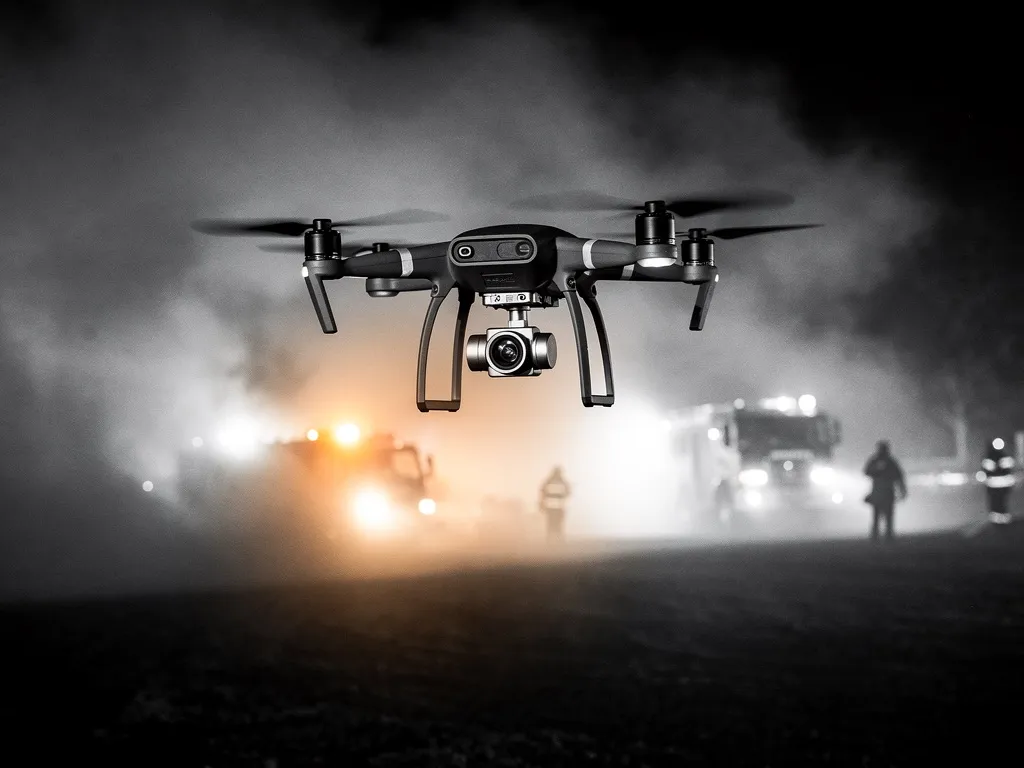
Dronium drones launch fully autonomously on defined alarm events, reach the scene before the first vehicle, and transmit live and thermal imagery directly to the devices of incident commanders, control rooms and ground crews. Thermal cameras reliably locate people in smoke, darkness and difficult terrain. Seamless integration with existing emergency-service infrastructure makes the system a full-fledged part of the response chain.
Alerts are triggered either automatically via connected hazard-detection systems (fire alarm, emergency call) or manually by the control room with a single click in the DroniumApp. The drone flies autonomously to the stored target location, holds a safe position over the scene, and streams live and thermal footage in real time — even while ground crews are still en route. Incident commanders gain a reliable situational picture before arrival and can deploy resources more precisely instead of assessing the situation on site first.
What a first-responder drone system has to deliver
A first-responder drone system isn't an observation tool that gets reviewed after the fact. It's an active piece of response equipment that has to deliver reliable information during one of the most critical phases of any incident — the initial size-up. The requirements are correspondingly high:
- Speed: the drone has to be airborne within seconds of the alarm. There is no room in this phase for manual launches, prep time, or dependence on available staff. Dronium systems launch fully autonomously — triggered by fire alarm systems, intrusion sensors, emergency calls, or manual activation from the control room.
- Image quality and sensors: daylight optics alone are often not enough in the field. Smoke, darkness, dense vegetation or poor weather drastically limit visual detection. That's why Dronium builds on a combination of high-resolution daylight and thermal cameras as standard — for detection performance that holds up regardless of light or visibility.
- Communication: a situational picture that only appears on the drone pilot's tablet is of no use to the commander in the vehicle. Dronium systems transmit live and thermal footage to multiple devices simultaneously — the control room, response vehicle, incident commander and ground crews all see the same picture at the same time.
- Integration: an add-on system that runs alongside existing structures and has to be operated separately creates more overhead than value in the field. Dronium systems are built to integrate seamlessly with existing control-room systems, emergency-service communication infrastructure, and digital incident-management platforms.
Live video: the situational picture in real time
The core of every first-responder mission is the live situational picture. Dronium drones stream camera and thermal data with minimal latency directly to the devices of every relevant responder — in parallel, with no delay.
In practice, that means the incident commander sees the fire spreading from inside the vehicle before even arriving on scene. The control room can tell whether missing people are on site. The ground crew gets GPS coordinates for the fastest route in and the most critical areas. Decisions that would otherwise only be possible after the first on-site reconnaissance can already be made on the way there.
The DroniumApp brings every data stream together on one unified interface. Drone position, camera feed, thermal analysis and georeferenced markers are all visible on a shared map view — intuitive to operate even under pressure.
Thermal detection: finding people when nothing else can
Smoke, darkness, dense vegetation — in many incident scenarios, conventional optics fail at exactly the moment reliable information is needed most. Thermal detection closes that gap.
Thermal cameras pick up the infrared signature of people, animals and heat sources regardless of light or visibility. Inside a smoke-filled building, an unconscious person is clearly visible on thermal, while the daylight camera shows nothing but impenetrable smoke. In open outdoor terrain, the thermal camera can spot a person in tall grass from hundreds of metres away.
Dronium drones stream thermal data in real time and automatically tag detected heat signatures with GPS coordinates. Ground crews get the exact position of a located person on their mobile device — no searching, no detours, maximum precision.
Typical scenarios for thermal detection include:
- Searching for people in building and industrial-site fires
- Missing-person searches in forests and open terrain
- Locating the injured after traffic accidents or disaster events
- Locating livestock in agricultural emergencies
- Monitoring incident perimeters for unauthorised persons
Integration with control rooms and emergency-service infrastructure
Integration with emergency services and public-safety organisations is one of the core requirements for a professional first-responder system. A drone system that runs alongside existing response infrastructure and has to be coordinated separately creates friction rather than value in the field.
Dronium systems are designed for seamless integration into existing structures. The DroniumApp communicates over open interfaces with digital control-room systems, incident-management software and radio communication systems. Alerts from existing fire alarm systems, intrusion detection systems or emergency-call systems automatically trigger the drone mission — with no manual steps and no lost time.
For fire departments and disaster-response authorities, that means the drone is an integrated piece of response equipment, not an add-on device. It appears in the incident-management system, its data feeds into the shared situational picture, and it's coordinated through the same communication channels as every other response asset.
Dronium supports the full technical integration — from connectivity analysis through system configuration to training for control-room staff and responders.
Coordinating with ground crews
A drone's situational picture only reaches its full value once it directly supports the work of ground crews. Dronium systems are built to tie the drone and the ground operation closely together.
Detected people, hazards or critical access routes are marked in the DroniumApp and tagged with GPS coordinates. This information is transmitted simultaneously to the ground crews' devices — as a map marker, a coordinate reading, or a direct voice-and-data feed into the communication system.
The drone operator — who, depending on the system setup, may be in the control room, in the response vehicle, or remote — takes on the role of an observer: watching the overall situation from the air, talking ground crews through the terrain, and dynamically repositioning the drone as the incident develops. Ground crews can be deployed with much greater precision — less searching, less lost time, and less risk to themselves.
Use cases in detail
Fire departments and disaster response
In fires, major incidents and disaster events, the first-responder drone delivers the first reliable situational picture: how the fire is spreading, the condition of buildings, the location of people, access routes and hazard zones — all visible before the first breathing-apparatus team even moves in. In large-area fires and extensive disaster scenarios, the drone helps coordinate multiple units from the air.
Emergency medical services
In traffic accidents, mass-casualty incidents or emergencies in hard-to-reach terrain, the drone gives EMS teams a fast overview: the number and position of casualties, the condition of the scene, and access routes for emergency vehicles. Resources can be requested and deployed more precisely — with a direct effect on response times.
Private site security services
For site-security organisations and private security providers, the first-responder system combines the strengths of perimeter surveillance with the capabilities of autonomous first response. When an alarm is triggered on site, the drone is on scene within seconds, giving the security operator the situational picture needed to make an informed call — false alarm, break-in, fire, or medical emergency.
DroniumApp: managing the response from one interface
The DroniumApp is the command centre of the entire system. It brings together drone control, live video, thermal analysis, GPS markers and communication with ground crews on one unified, intuitive interface.
For first-responder use, the DroniumApp offers automatic alarm triggering and mission launch control, simultaneous transmission to multiple devices, georeferenced markers for detected people and hazards, logging of all mission data for after-action review, and interfaces to control-room systems and emergency-service communication infrastructure. Complete documentation is available after every mission — ready for debriefs, official reports and insurance claims.
Certification and legal compliance
First-responder drones frequently operate in controlled airspace, near response vehicles, and over built-up areas. Dronium ensures every mission is fully compliant with air traffic regulations and EASA rules. Special permits for operation in controlled zones are obtained in close coordination with the relevant aviation authorities. Every pilot and operator we deploy holds the qualifications required for professional operation in an emergency-service environment.
→
Benefits at a glance
- Situational picture before the first vehicle arrives
- Reliable detection of people even in poor visibility
- Seamless integration into existing control-room and emergency-service systems
- More precise resource deployment instead of on-site assessment
→