

Solutions — 02
Geo Mapping & Inframapping
A map is only as good as the data behind it. Dronium delivers the data foundation that modern planning, inspection and infrastructure management actually need.
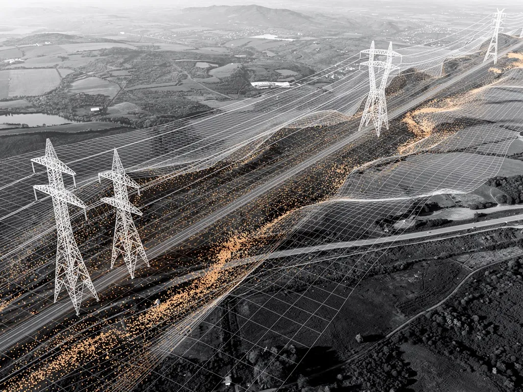
Outdated as-built plans, imprecise terrain models or missing information about the condition of pipelines and land cost time, money and, in the worst case, safety. Dronium delivers the data foundation that modern planning, inspection and infrastructure management genuinely need — captured from the air, accurate to the centimetre, in a fraction of the time classic surveying methods require.
Our geo mapping and inframapping services cover drone-based terrain surveys, LiDAR scanning, thermography, and the creation of professional terrain models and elevation maps. Every dataset is captured and processed with the DroniumApp and delivered in ready-to-use formats — directly compatible with your existing GIS, CAD or planning systems.
What is drone geo mapping?
Geo mapping is the systematic, georeferenced capture of terrain, land and objects from the air. Unlike classic ground-based surveying, a drone can cover large areas in a single flight, gathering consistent data from one uniform perspective and delivering results that traditional methods simply cannot match in either speed or resolution.
The output of a geo mapping mission isn't a photo — it's a structured dataset: georeferenced, true to scale and ready for further processing. Depending on the sensor used, this produces orthophotos, digital terrain models (DTM), digital surface models (DSM) or detailed 3D point clouds. These datasets form the basis for planning, documentation, asset inventories and analysis — in agriculture just as much as in infrastructure management.
Inframapping: seeing infrastructure before problems arise
Inframapping — drone-based mapping and inspection of infrastructure — goes a step further than classic geo mapping. It's not just about surveying land; it's about capturing and documenting the actual condition of power lines, corridors, masts, roofs or pipe systems.
Utilities, grid operators and energy suppliers all face the same challenge: infrastructure that is often decades old has to be inspected, assessed and, where necessary, refurbished on a regular basis. Walking or driving inspections are slow, expensive and often produce an incomplete picture. Drone-based inframapping changes this fundamentally.
Dronium systems capture line corridors, routes and technical installations systematically, reproducibly and in far less time. The resulting data feeds directly into asset-management systems, maintenance schedules or GIS databases — laying the groundwork for predictive maintenance instead of reactive repair.
Our services in detail
Digital terrain models and elevation maps (DEM/DSM)
Digital terrain models (DTM) and digital surface models (DSM) are among the most fundamental products of geo mapping. A DTM describes the bare earth surface without vegetation or buildings, while a DSM captures the surface as it actually appears, including everything on it.
Dronium produces both model types with positional accuracy down to a few centimetres, based on high-resolution image flights using RTK positioning or supplementary ground control points. Results are delivered as GeoTIFF, LAS, LAZ or in custom formats, and import directly into common GIS systems such as QGIS, ArcGIS or AutoCAD.
Applications range from slope-stability analysis in agriculture to drainage-system planning and volume calculations for earthworks or landfill sites.
LiDAR scanning
LiDAR (Light Detection and Ranging) is the most precise tool available for drone-based terrain capture. Unlike image-based photogrammetry, LiDAR sees through vegetation and delivers reliable ground points even under dense tree cover.
For forestry, that means precise stand models, stem-count estimates and biomass analysis without labour-intensive ground surveys. For infrastructure operators, it means exact corridor profiles even in overgrown terrain, clearance calculations beneath power lines, and early detection of vegetation risk.
Dronium deploys the latest generation of LiDAR systems, achieving point densities of over 100 points per square metre. The resulting point clouds are classified, filtered and delivered as structured datasets, ready to feed directly into your planning or inspection system.
Thermography and infrared imaging
Thermal drone cameras capture what the human eye and conventional optics cannot: temperature differences, heat loss, electrical anomalies and moisture-related damage. In inframapping, thermography is one of the most effective tools for predictive maintenance.
In the energy sector, infrared imaging identifies overheating connections on overhead lines, faulty insulators or hotspots on solar installations long before they cause an outage or a fire. A single thermal drone flight over an overhead line can pinpoint weak points across kilometres of cable — work that would take a manual inspection days to complete.
In agriculture, thermography reveals drought-stress patterns, pest infestation or irrigation problems across fields and orchards. Combined with multispectral NDVI analysis, it builds a precise picture of plant health — the basis for targeted fertilisation, irrigation and treatment under a precision-farming approach.
Where geo mapping and inframapping deliver the most value
Energy and utility networks
Grid operators and energy suppliers are under growing pressure: ageing infrastructure, ambitious expansion targets, and shrinking budgets for maintenance and inspection, all at once. Drone-based inframapping is the answer to that triple challenge.
Dronium carries out regular survey flights over high-voltage corridors, medium-voltage networks, wind farms, solar installations and transformer stations. The resulting data — combining LiDAR, thermography and high-resolution imagery — is structured and fed directly into the grid operator's asset-management systems, creating a continuous digital record of the condition of the entire network.
Critical findings are automatically flagged, prioritised and made available to the responsible engineers in the DroniumApp. Work that used to take weeks of fieldwork is now completed in days — with better data quality and complete documentation.
Agriculture and forestry
Precision farming is impossible without reliable geodata. Geo mapping provides the spatial foundation for every decision made on the land — from planting plans to nutrient optimisation to yield estimation.
For farms and forestry businesses, Dronium delivers the right data products for the task at hand — from terrain models and elevation maps to LiDAR stand data and thermal vegetation analysis. Results are delivered in formats that import directly into precision-farming systems, forest-inventory software or GIS applications. On request, Dronium also carries out recurring seasonal flights and supplies the resulting change data as a time-series analysis.
DroniumApp: from flight to usable map
Capturing data is one thing — making it usable is another. The DroniumApp doesn't just control the drone flight; it also handles the entire data-processing pipeline and outputs the results in usable formats.
Mission plans are created directly in the app, with flight paths automatically optimised for maximum image overlap and terrain following. Once the flight is complete, the app triggers the processing pipeline — image alignment, point-cloud generation, modelling — and delivers the final result straight into the desired output structure. Customers with recurring mapping tasks can save complete workflows and repeat them with a single click.
Data can be exported as GeoTIFF, LAZ/LAS, DXF, KMZ, Shapefile, or transferred directly into third-party systems via API. Access for external parties — planning offices, surveyors or authorities — can be set up with granular, time-limited permissions.
Why Dronium for geo mapping and inframapping?
Geodata is only as valuable as its precision and its currency. Dronium delivers both — with certified systems, experienced pilots, and software that covers the entire process from mission planning to data handover.
We work with grid operators, farms, forestry businesses and infrastructure planners, and we understand the requirements these industries place on geodata. Our systems are EASA-compliant, our results are certifiable, and our team understands both the technology and your specific requirements.
→
Benefits at a glance
- Centimetre-accurate data instead of rough estimates
- Direct import into existing GIS and CAD systems, no format conversion needed
- Repeat surveys reveal change objectively and automatically
- Foundation for predictive rather than reactive maintenance
→