
Solutions — 06
Drones in Agriculture
Precision farming requires current, field-accurate data — and the ability to act on it immediately.
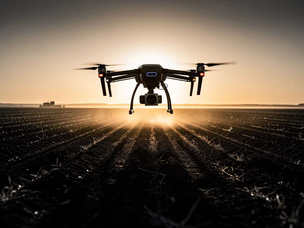
Dronium supports arable farms, orchards, vineyards and forestry businesses with drone-based field analysis (water content, plant vitality, damage zones), zone-specific irrigation control, drone seeding for reforestation and overseeding, and thermal wildlife rescue during mowing. The DroniumApp connects mapping and active operations in a single continuous workflow — exportable to common agricultural and forestry planning software.
Multispectral imagery reveals plant vitality and water stress long before they're visible to the naked eye, enabling targeted irrigation, fertilisation or overseeding — instead of treating an entire field uniformly. Ahead of mowing, early-morning thermal flights reliably detect fawns and other wildlife hiding in tall grass, allowing affected areas to be excluded or animals to be gently driven off beforehand. The DroniumApp links all mapping and operational data in a single workflow that exports directly into common agricultural and forestry planning software.
Precision farming: why drones are changing agriculture
Precision farming means applying agricultural measures where they're actually needed, rather than uniformly across an entire field: fewer inputs where they add nothing, more resources where they make the biggest difference. That approach cuts costs, protects the environment and raises yield per hectare.
Drones are the ideal tool for precision farming because they do both jobs at once: capturing a field in high resolution and acting on that data with precision. Dronium brings analysis and action together in one integrated system. One drone maps the crop, the DroniumApp processes the data, and the next drone acts on it — with millimetre-accurate positioning and application rates tailored zone by zone.
Assessing the condition of arable land
Before you can act, you need to know the condition of the field. Dronium surveys arable land systematically and delivers a precise picture of the current crop — the visible and the invisible.
Water content and drought stress
Multispectral cameras pick up drought-stress patterns long before they become visible to the naked eye. Plants suffering from water shortage change their reflectance in the infrared range — a signal Dronium drones detect reliably and map across the whole field. The result is a high-resolution map of soil water content and plant drought stress that forms the direct basis for zone-specific irrigation decisions.
Thermal imagery adds to that picture: cooler zones on the heat map point to adequately moist areas, warmer zones to potential drought-stress hotspots. Combined, these maps enable precise, resource-efficient irrigation control even across large areas.
Plant growth and crop development
NDVI maps (Normalized Difference Vegetation Index) show how vital the crop is across the entire field — broken down by zone and comparable across growth stages. Weak spots in the stand, emergence problems after seeding, and damage from waterlogging or soil compaction all become visible early, so they can be treated specifically.
For orchard and vineyard operators, Dronium flights during the growing season deliver precise data on leaf area index, shoot growth and fruit set — the basis for needs-based fertilisation, thinning and harvest planning.
Detecting damage and destruction
Hail damage, wildlife damage, waterlogged patches, erosion or pest infestation can all be captured quickly and comprehensively from the air. Dronium flights after a damage event produce precise damage assessments with georeferenced damage sites, area measurements and photo documentation — usable for insurance claims, subsidy applications or internal farm planning.
Drone-based irrigation control
Water is one of the scarcest agricultural resources — and one of the most inefficiently used. Blanket irrigation waters dry and wet patches alike, puts unnecessary strain on water supplies, and encourages waterlogging, fungal disease and nutrient leaching.
Dronium-based irrigation control replaces that with a zone-specific approach. Irrigation zones are defined from current drought-stress and moisture maps, and application volumes are adjusted to actual need. The DroniumApp converts the mapping data directly into irrigation plans compatible with modern precision irrigation systems.
For farms using drip irrigation or zone-specific sprinkler systems, that means automatic adjustment of irrigation intensity based on current drone data, with no manual analysis and no delay. Water goes where it is needed — not simply where it can be applied.
Drone seeding
Drone seeding is no longer a technology of the future — it is in practical use today, opening up possibilities conventional seed drills cannot match. Dronium carries out drone seeding in three key contexts:
Reforestation and forestry
After storms, bark-beetle infestations or planned felling, forest areas often need to be replanted quickly and comprehensively. Manual reforestation is extremely labour-intensive, slow, and barely scalable on steep or difficult terrain.
Dronium drones can disperse tree and shrub seed — including pre-germinated seed pods — with high precision and in a fraction of the time manual methods take. Seeding plans are built in the DroniumApp from terrain models, soil maps and species-suitability data, then transferred directly into the drone mission. On land that is difficult for people to access, drone seeding is often the only practical option.
Overseeding arable land
Gaps in a crop caused by emergence problems, frost damage or pest infestation can be overseeded precisely by drone — zone by zone, based on the crop mapping, without bringing heavy machinery onto the field and without damaging the existing stand. For sensitive soils or late in the growing season, machine-free drone seeding is a decisive advantage.
Greening special-purpose areas
Embankments, field margins, compensation areas or legally mandated flower strips can be greened quickly, evenly and with full documentation by drone — using species-specific seed mixes and precise, zone-by-zone application rates.
Wildlife protection during mowing
Every year, tens of thousands of fawns and other young animals die in mowing accidents across the DACH region — because their instinct is to freeze rather than flee, so mowing machinery doesn't spot them in time. It's a problem where animal welfare and farming interests align, and one Dronium has a proven technical answer for.
Thermal wildlife rescue
Dronium drones fitted with thermal cameras fly over meadows immediately before mowing — ideally in the early morning, when the temperature contrast between young animals and their surroundings is greatest. Fawns, hares and other young animals show up clearly as heat signatures on the thermal map.
Animals detected this way are marked in the DroniumApp with exact GPS coordinates and shown to the machine operator in real time on a mobile device. The animal can then be gently driven off or carried to safety before mowing begins — quickly, systematically, and without having to walk the entire field. After the rescue, a follow-up drone flight confirms the area is clear.
Why drones outperform other methods
Searching a field on foot is time-consuming, physically demanding and unreliable in tall vegetation. Wildlife cameras only cover single points. Drones cover the entire area systematically, quickly, and with a detection rate well above manual methods — a single drone can cover several hectares in the time a ground team needs for half a hectare.
Coordinating the service is simple: the farmer shares the mowing date, and Dronium plans and carries out the flight — with full documentation of the areas searched and the animals rescued. For farms that want to run wildlife protection themselves, Dronium also offers training and equipment rental.
DroniumApp: connecting data to action
In agriculture, the DroniumApp is more than control software — it is the operational hub that ties together crop mapping, application planning and documentation of every action in a single workflow.
Crop maps from drone flights convert directly into application plans. Seeding and irrigation missions are optimised automatically. Wildlife-protection flights are documented with location maps and rescue logs. Every result can be exported to farm-management platforms such as 365FarmNet, xarvio or AgroOffice, as well as into official subsidy-application formats.
For operations spanning multiple fields or sites, the DroniumApp provides central management of every operation — with time-series comparisons across growing seasons and automatic alerts when defined thresholds are crossed, such as critical drought stress or unusual changes in crop condition.
Why Dronium for your farming operation?
Precision farming isn't an end in itself — it's an economic lever. Lower input use, targeted resource deployment and early damage detection all show up directly in the bottom line. Dronium provides the technical foundation: reliable systems, field-tested operating concepts, and software that works in daily farm operations — not just in a demo.
We understand what arable farms, orchards, vineyards and forestry businesses need. We work around seasonality, weather windows and tight schedules. And we're there when it counts — not just at project kickoff.
→
Benefits at a glance
- Targeted rather than uniform irrigation and fertilisation
- Early detection of plant stress before visible damage occurs
- Reliable wildlife rescue ahead of mowing through early-morning thermal flights
- Seamless data export into existing agricultural and forestry planning software
→